
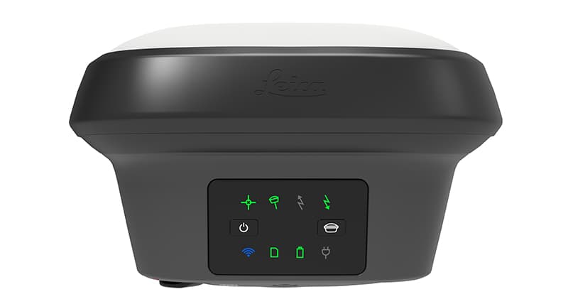
Leica GS18 T RTK GNSS Smart Antenna
The fastest, immune-to-magnetic-interference tilt-compensating GNSS
Detailed Technical Overview & Engineering Architecture
Core Engineering Capabilities
Technical Specifications & Metrology Tolerances
- Modem
- Integrated 4G LTE cellular data module
- Channels
- 555 channels multi-frequency
- Waterproofing
- IP68 immersion up to 1.4m depth
- Tilt Compensation
- Real-time IMU, calibration-free, immune to magnetic interference
- Internal Battery Life
- Up to 7.5 hours continuous RTK UHF/LTE
- RTK Baseline Accuracy
- Hz: 8 mm + 1 ppm / V: 15 mm + 1 ppm
- ModemVariant
- Integrated 4G LTE cellular data module
- ChannelsVariant
- 555 channels multi-frequency
- WaterproofingVariant
- IP68 immersion up to 1.4m depth
- Tilt CompensationVariant
- Real-time IMU, calibration-free, immune to magnetic interference
- Correction TelemetryVariant
- 4G LTE Network Rover
- Equipment PackageVariant
- Instrument Only (Hard Case & Battery)
- Internal Battery LifeVariant
- Up to 7.5 hours continuous RTK UHF/LTE
- RTK Baseline AccuracyVariant
- Hz: 8 mm + 1 ppm / V: 15 mm + 1 ppm
Compatible Precision Accessories & Tooling
Factory-certified tripods, prisms, and carbon poles engineered for optimal mechanical stability.
2-meter carbon fiber survey pole with snap-lock positioning and integrated circular bubble vial. Perfect for GNSS antennas and robotic prisms.
₹340Technical Documentation & Downloads
Verified manufacturer datasheets, field operating manuals, and metrology tolerances.
Leica GS18 T Quick Start & Field Survey Guide
6.5 MB • PDF
Frequently Asked Questions
Related Surveying & Geosystems Hardware
Complementary rovers, total stations, and detection units in the same domain.

Leica SmartPole
Flexible surveying mast for fast GNSS collection
A purpose-built pole system that makes field measurement more ergonomic and efficient.
Quick setup

Leica GS18 T
Robust rover for modern field crews
Flexible GNSS RTK rover built for roads, rail, and infrastructure mapping.
Tilt compensation

Leica AP20 AutoPole
Smart, ergonomic pole automation
Autonomous pole setup for high-productivity GNSS workflows.
Automated pole awareness